Heritage · Landmark
Timgad: the city Rome drew before it built it
A colony for retired legionaries was surveyed and raised in one operation on a high plain below the Aurès, so its ground plan is not a record of how a city grew but a drawing of how Romans thought a city should work. Sand covered it for a thousand years and kept it. Among the buildings the sand kept is a public library, paid for out of a dead man's will, with the sum and his name cut in stone above the door.Written to last.
By Confinity Heritage Editorial · 2026-08-25 · 7-minute readQuiet tools, kept out of the way.
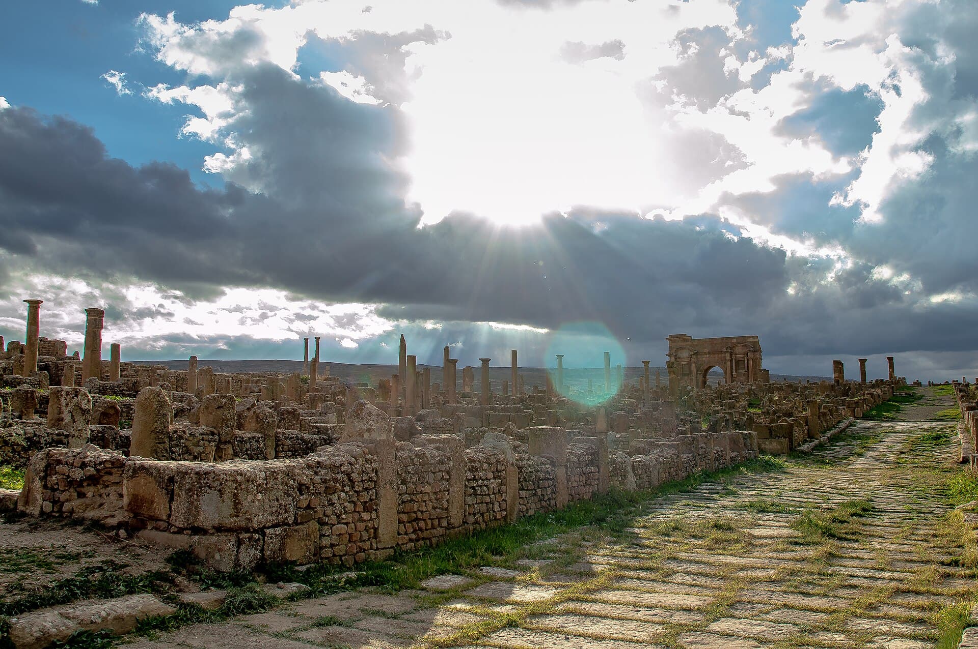
On the northern slopes of the Aurès, at about a thousand metres, stands a Roman city with no earlier life. The UNESCO citation reaches for the phrase ex nihilo: Thamugadi was created out of nothing as a military colony by Trajan in AD 100. It lies in Algeria, 35 kilometres east of Batna, on the World Heritage List since 1982.
Most ancient cities are arguments carried on between generations. Timgad was surveyed, gridded and put up in one operation, so its plan records no negotiation. It records what a Roman military engineer believed a town was.
The Third Augustan Legion had been quartered at Lambaesis since AD 81. Under its legate Lucius Munatius Gallus, it received Trajan's order to plant a colony for its veterans twenty kilometres away, where the road north from Cirta met the road running east to Theveste and on to Ammaedara and Carthage.
The full name was Colonia Marciana Traiana Thamugadi, honouring Trajan and his elder sister Ulpia Marciana. The last word is not Latin: Thamugadi is Berber, a plural of Tamgut, meaning peak or summit, the name the ground already had. Half imperial family, half local geography, in that order.
The job was military before it was civil: a second-line town at the foot of the Aurès, watching the routes into the mountains, laid out for some fifteen thousand people. Nothing about it resembles the slow Punic-into-Roman layering of a coastal city such as Leptis Magna, trading seven centuries before Rome arrived.
The original town was a walled square roughly 355 metres a side, about twelve hectares, enclosed rather than fortified. Two colonnaded streets cut it into quarters: the decumanus maximus running east to west, the cardo maximus running north for 180 metres in slabs of bluish limestone. The cardo does not cross the town. It stops at the forum.
Inside that square the surveyors ruled a grid of insulae about twenty metres each way, a dozen blocks across, and set the public buildings into the resulting cells. This is the plan of a legionary camp with tents replaced by houses, and the World Heritage citation says so, crediting the grid to military engineers whose encampment plan governed the site for centuries.
That is what makes the place unusual rather than merely well preserved. Roman writing on town planning is thin and theoretical. Here the theory sits on the ground at full scale, because nothing was there to compromise it: no older lane, no shrine in the wrong place, no river, no hill except the low rise the theatre was cut into.
At the western end of the decumanus stands the triple arch everyone calls the Arch of Trajan, twelve metres high, its central passage wide enough for the carts that wore ruts into the paving. The attic carries the text recording Trajan's foundation of the colony, which is where the name comes from. The building is later: the detached columns, the flanking aediculae and the curved pediment point to the end of the second century or the start of the third, so what stands is a grander replacement on the site of Trajan's west gate.
One street south of the forum, the theatre was cut into a hillock. It is about 63.6 metres across and held at least 3,500 people; an inscription of 158 and a dedication of 167 to 169 place its completion under Antoninus Pius and Marcus Aurelius. Its stage building is gone. The forum is a paved rectangle of about fifty metres by forty-three, colonnaded on four sides, with the council house and basilica around it and a latrine alongside whose seat arms are carved dolphins.
Then the diagram fails, which is the second interesting thing here. Within fifty years the colony had outgrown its square, spreading from twelve hectares to about fifty, the new quarters following roads instead of a survey. Most of what Timgad is photographed for stands out there: the Capitolium on its thirty-eight steps, the market of Sertius, most of the fourteen baths counted across the city. At the Great South Baths the southbound cardo simply bends west. A camp holds its shape because a garrison is a fixed number of men. A town is not.
A short walk from the arch is a building almost no other Roman site can show. Public libraries existed across the empire and are named in dozens of inscriptions, but very few survive as buildings whose plan can be read. This one does.
It occupies a rectangle about twenty-five metres by twenty-three. A U-shaped colonnaded portico runs around three sides of an open court, and at the back is a large semicircular hall with a rectangular room on either side. The curved hall was vaulted and did several jobs at once: reading room, book store, perhaps lecture room. Oblong niches in its wall held the wooden presses the rolls were kept in, which on the evidence of Ephesus had backs, sides and doors. The usual estimate is room for three thousand rolls.
The inscription that once sat above the entrance now leans against the back wall of the courtyard. It records that the work was completed out of the liberality of Marcus Julius Quintianus Flavius Rogatianus, a man of senatorial rank, who left the colony 400,000 sesterces in his will. Catalogued as AE 1908, 12, it is all we have of him: no career, no dates, no second inscription. The library went up on the plot of a private house, probably in the late third or early fourth century.
Consider where this is: 480 kilometres from Algiers and a great deal further from Rome, a town founded by retiring soldiers to watch a mountain range, most of whose first citizens had never seen Italy. A man from that place decided what it still lacked was somewhere to keep books, left the price of it in his will, and had the sum and his name cut into stone over the door, where it would outlast him.
He was right about the last part. Not one title is known; whatever those three thousand rolls held went the way of every other provincial library, without a catalogue or a quotation to say what was in it. The room, though, is still a room, the niches still at reading height. And the sentence naming the man who paid is legible yet, propped against a wall in a courtyard in the Aurès, seventeen centuries after he stopped being able to check.
The forum paving holds graffiti, and one slab carries three short lines: VENARI LAVARI / LVDERE RIDERE / OCCEST VIVERE. Catalogued as CIL 8.17938, it is the most quoted thing at Timgad. Read straight: to hunt, to bathe, to play, to laugh, that is to live.
The versions in circulation are looser than they look. OCCEST is hoc est written as it was said rather than as it was spelled, so the Latin is more casual than the English allows. And this is no civic motto on a monument: it is scratched into a floor, listed by John Ferguson among graffiti that include a gaming board and a phallus. The slab is itself a playing surface, those lines setting out the field for ludus duodecim scriptorum, a race game of twelve marks.
Which makes it better evidence rather than worse. A motto tells you what a town wanted carved; a board tells you what people did while they waited. Even the hunting is uncertain, since venari in a North African city could as easily mean watching the staged beast shows as going out after game.
Timgad declined from the third century and became a Christian town, then a Donatist stronghold under its bishop Optatus. The Vandals came in 430, and attacks out of the Aurès emptied the city by 484. In 539 the Byzantine general Solomon retook the site and built a fort south of it from blocks quarried out of the Roman monuments, the theatre among them. After the eighth century nobody lived there.
Then the ground took it. Sand, ash and fine soil drifted over the ruins and levelled them; at the theatre the fill reached seven metres deep at the inner angle of the south entrance. Burial of that kind hides a building and preserves it in the same act. James Bruce reached the ruins in December 1765 and called them "a small town, but full of elegant buildings"; he was not believed until Robert Lambert Playfair went to check in the 1870s.
French control began in 1881 and excavation ran almost continuously until 1960. Edmond Duthoit cleared the theatre between 1885 and 1887; Albert Ballu rebuilt the seating and restored the arch around 1900. The fieldwork was skilled. It was not disinterested. Bonnie Effros has traced how French archaeology in Algeria grew out of the violence of the conquest, and how the Roman past it uncovered was recruited to argue that France was resuming an interrupted European tenancy of North Africa.
The effect shows in what is on display: the site was cleared to present a Roman colony, and it presents one superbly. The Berber name of the ground, the Libyan god who may lie behind the temple called Saturn's, the mountain people who took the town in 484: all thinner in the record, because none of that was what the digging was for.
The property covers 90.54 hectares and has never been on the List of World Heritage in Danger. The World Heritage Centre calls it remarkably stable, undamaged by earthquake or weather: it is high, it is dry, and because it was buried rather than reoccupied, nothing modern was built on top of it.
The pressures are human. UNESCO lists visitors climbing on fragile structures, service vehicles driven across them, graffiti and rubbish. The Timgad music festival used the ancient theatre from 1978 until the weight of staging and audiences told on the stone; a new open-air theatre went up beside the site in 2010 and the festival moved into it. A museum at the entrance holds eighty mosaics lifted from the houses and baths.
What a visitor walks into is still the plan. The streets run where the surveyors ruled them, the ruts sit where the carts wore them, and from the arch the whole original square is taken in at a look, which is the point of a grid. Off to one side, in a courtyard whose portico still stands on three sides, is the room a man paid for out of his estate, his name propped against the back wall.
Founded from nothing in the year 100
The camp drawn as a town
The arch, the theatre, and the place where the grid gives out
The library of Rogatianus
Venari lavari ludere ridere
Sand, and the men who cleared it
Standing in it now
References and resources
- UNESCO World Heritage Centre. "Timgad." World Heritage List, property no. 194, inscribed 1982, criteria (ii)(iii)(iv); property 90.54 ha. whc.unesco.org/en/list/194.
- Pfeiffer, Homer F. "The Roman Library at Timgad." Memoirs of the American Academy in Rome 9 (1931): 157-165.
- Ferguson, John. "Roman Algeria." Greece & Rome 13, no. 2 (1966): 169-187, with the forum paving and CIL 8.17938 at 174-175.
- Boeswillwald, Emile, René Cagnat and Albert Ballu. Timgad, une cité africaine sous l'Empire romain. Paris, 1905; and Albert Ballu, Les ruines de Timgad, antique Thamugadi: sept années de découvertes (1903-1910). Paris, 1911.
- Effros, Bonnie. Incidental Archaeologists: French Officers and the Rediscovery of Roman North Africa. Ithaca: Cornell University Press, 2018.
- Livius.org. Jona Lendering, "Thamugadi (Timgad)." livius.org/articles/place/thamugadi-timgad.
- Following Hadrian Photography. "Thamugadi (Timgad)," 28 April 2025, with the founding dedication, the library inscription AE 1908, 12, and the forum gaming board. followinghadrianphotography.com.
- Wikipédia. "Théâtre de Timgad," with the excavation record of Edmond Duthoit and Albert Ballu and the relocation of the music festival. fr.wikipedia.org.